Urban Design
Activate Bovisa through a network of urban nodes that energize the district from within.
Urban ActivationInfrastructurePublic Space
LocationBovisa, Milan, Italy
Year2024
Project Sections
01
Section
Analysis & Impressions
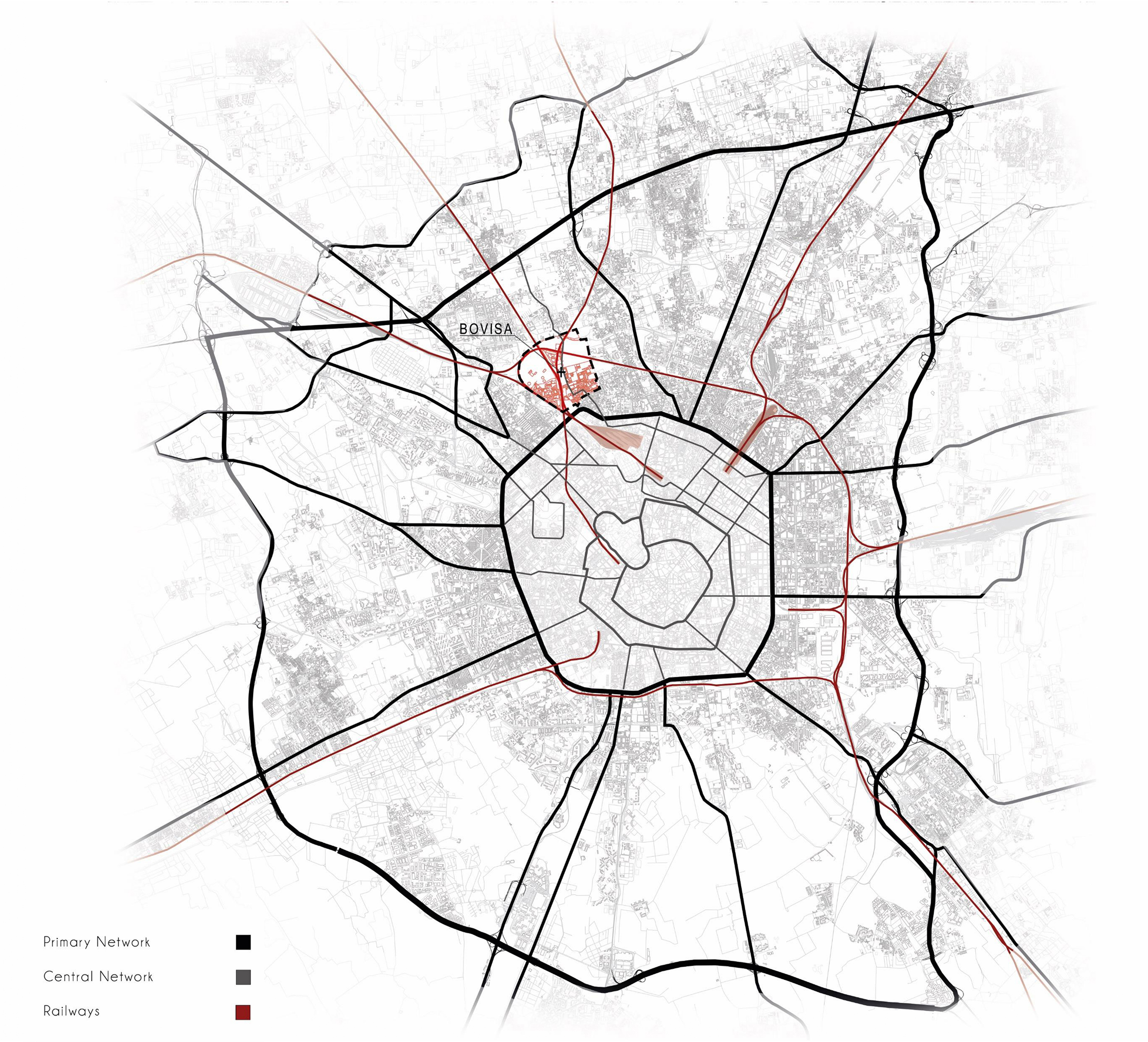
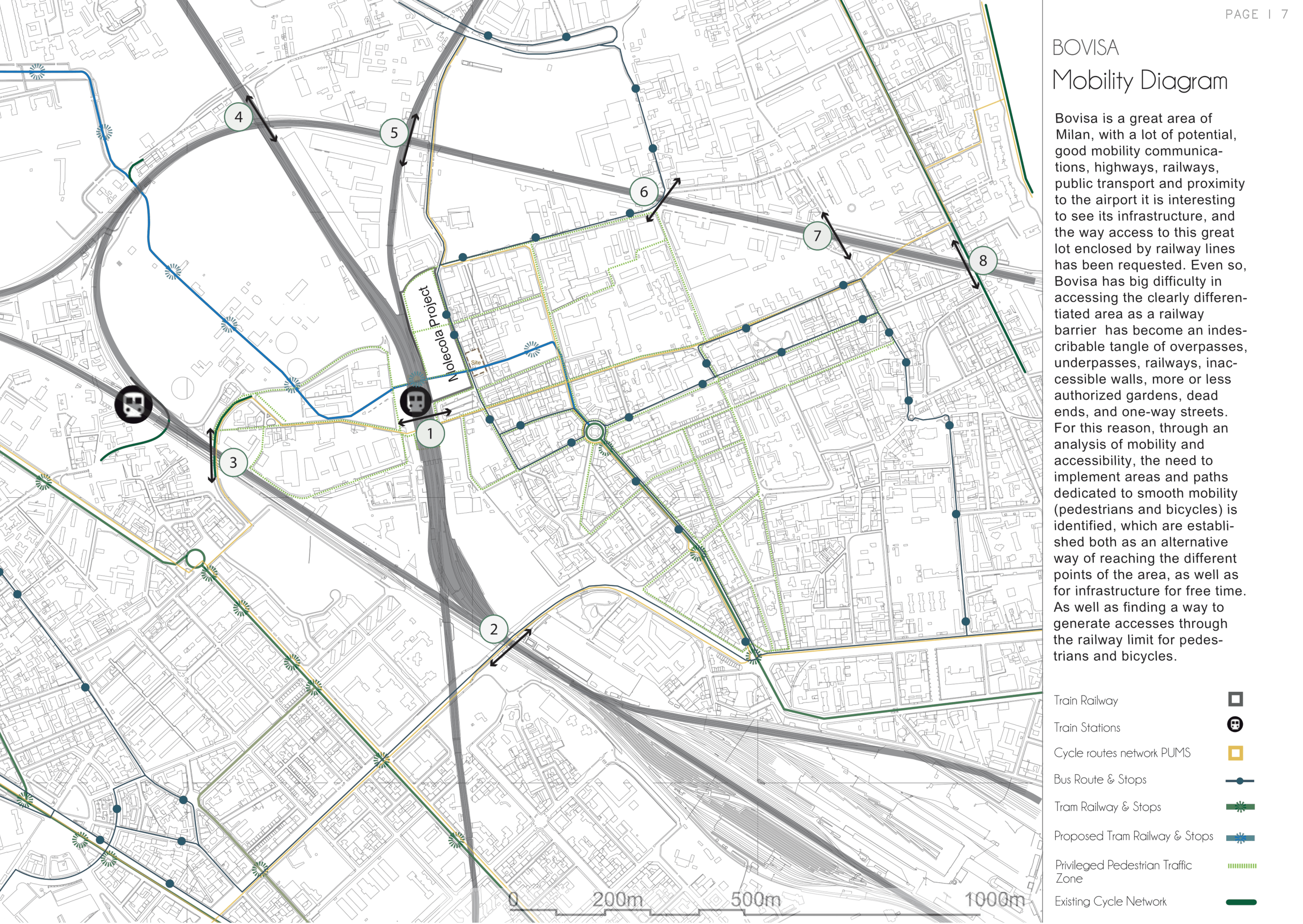
Bovisa mapped — its industrial bones, academic energy, and severed connections read against Milan's broader urban fabric.
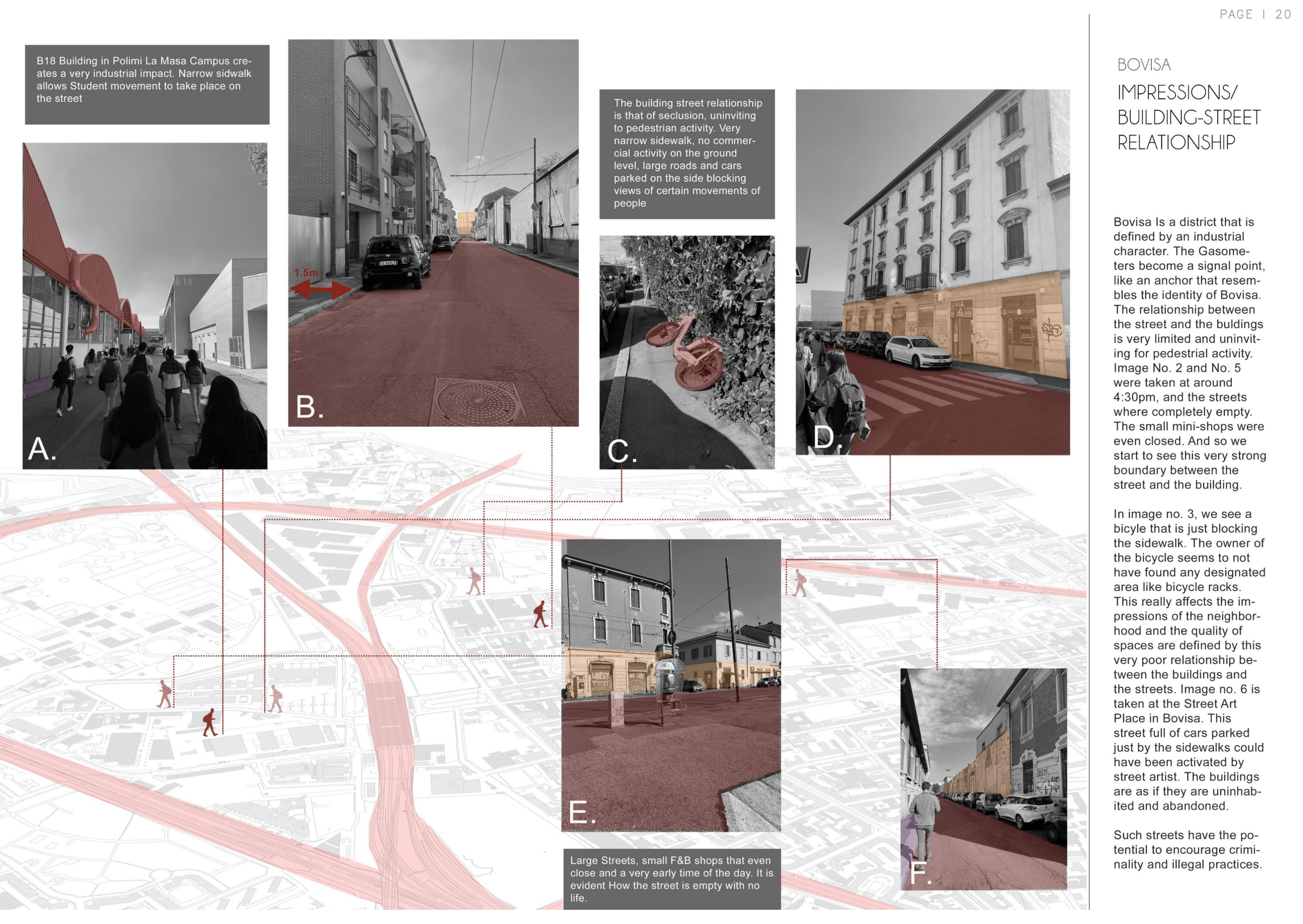
First impressions of a district in transition: rich in potential, fragmented in delivery. The building-to-street relationships tell the story before any diagram does.
02
Section
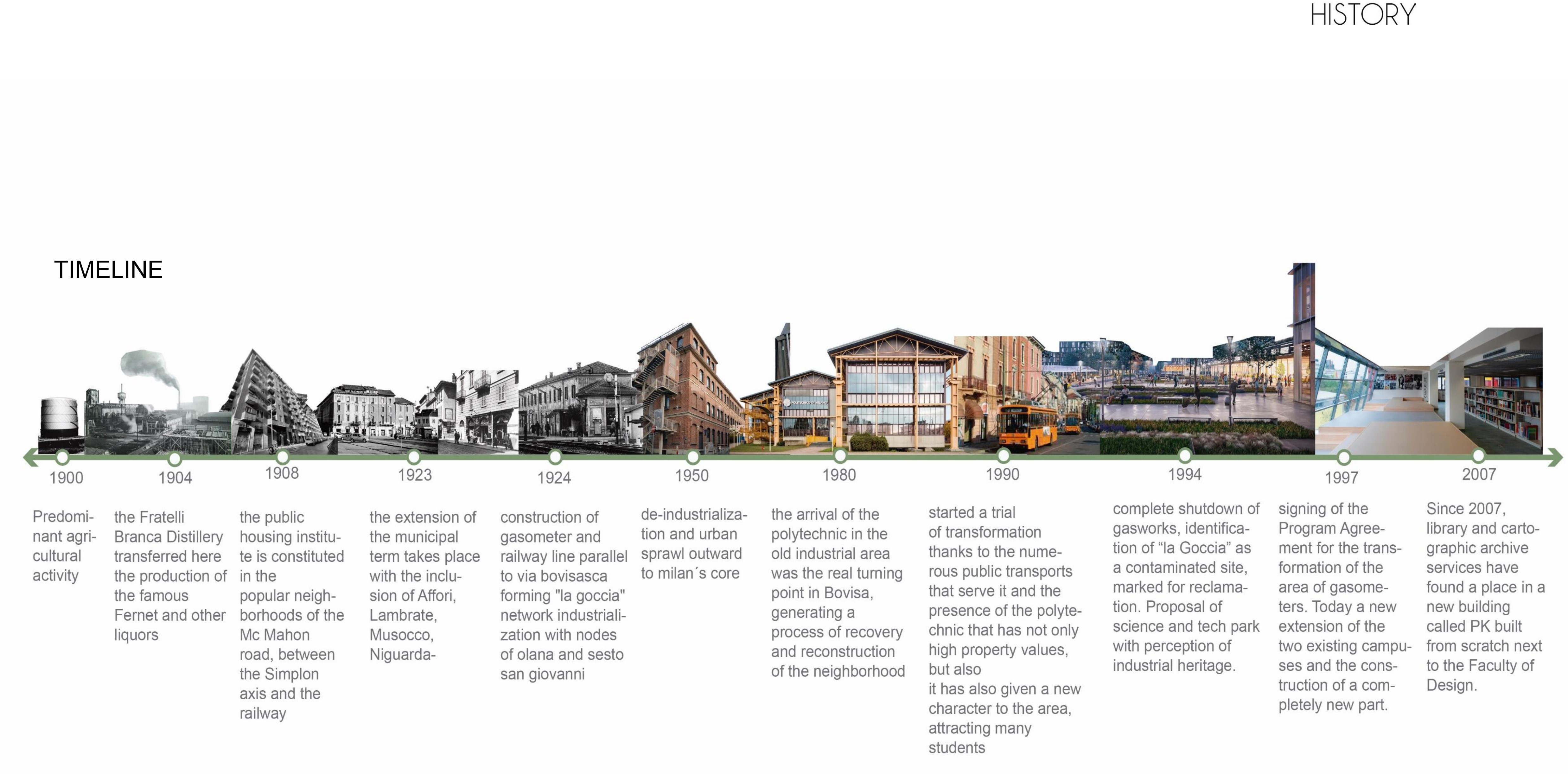
Problems & History
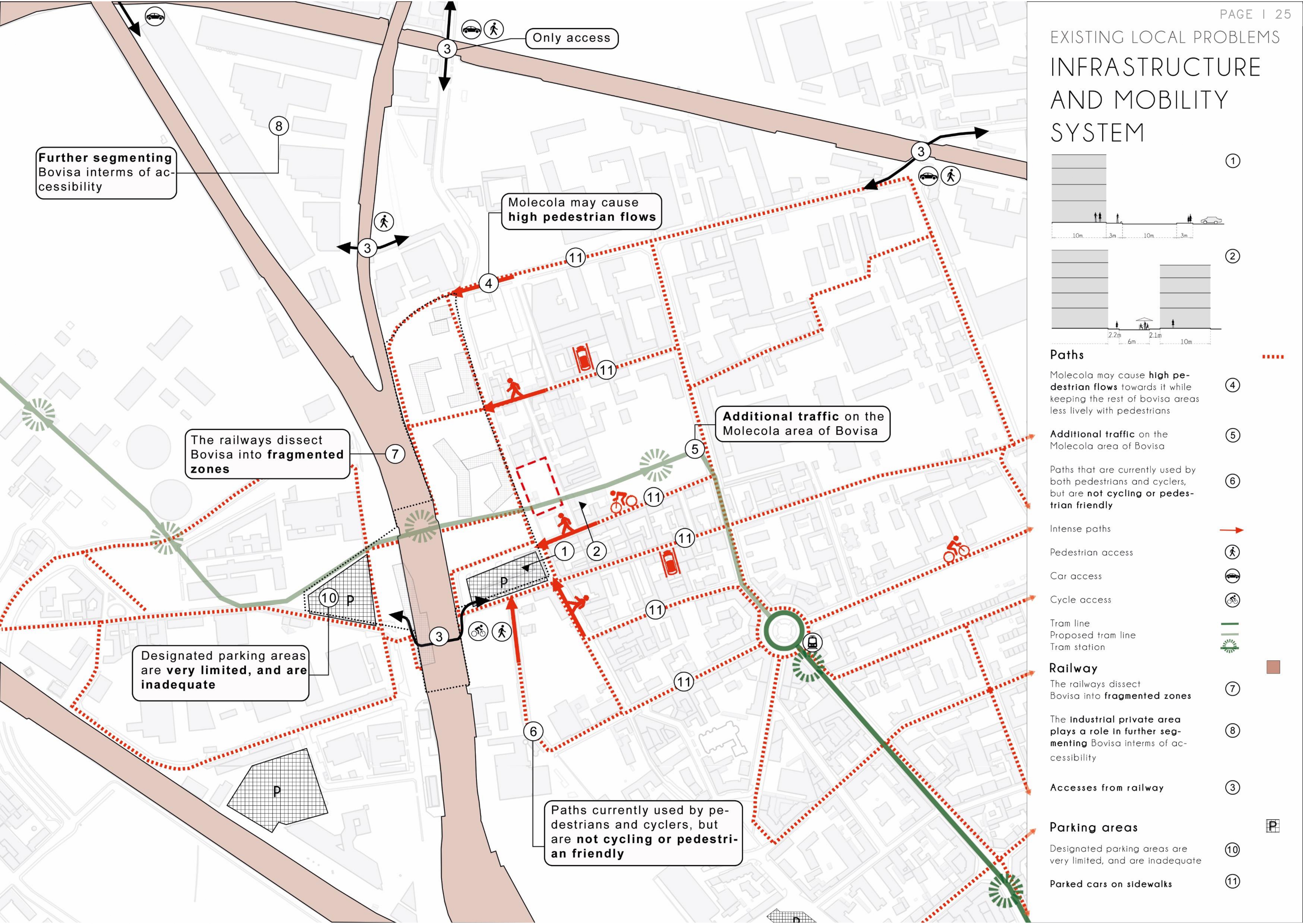
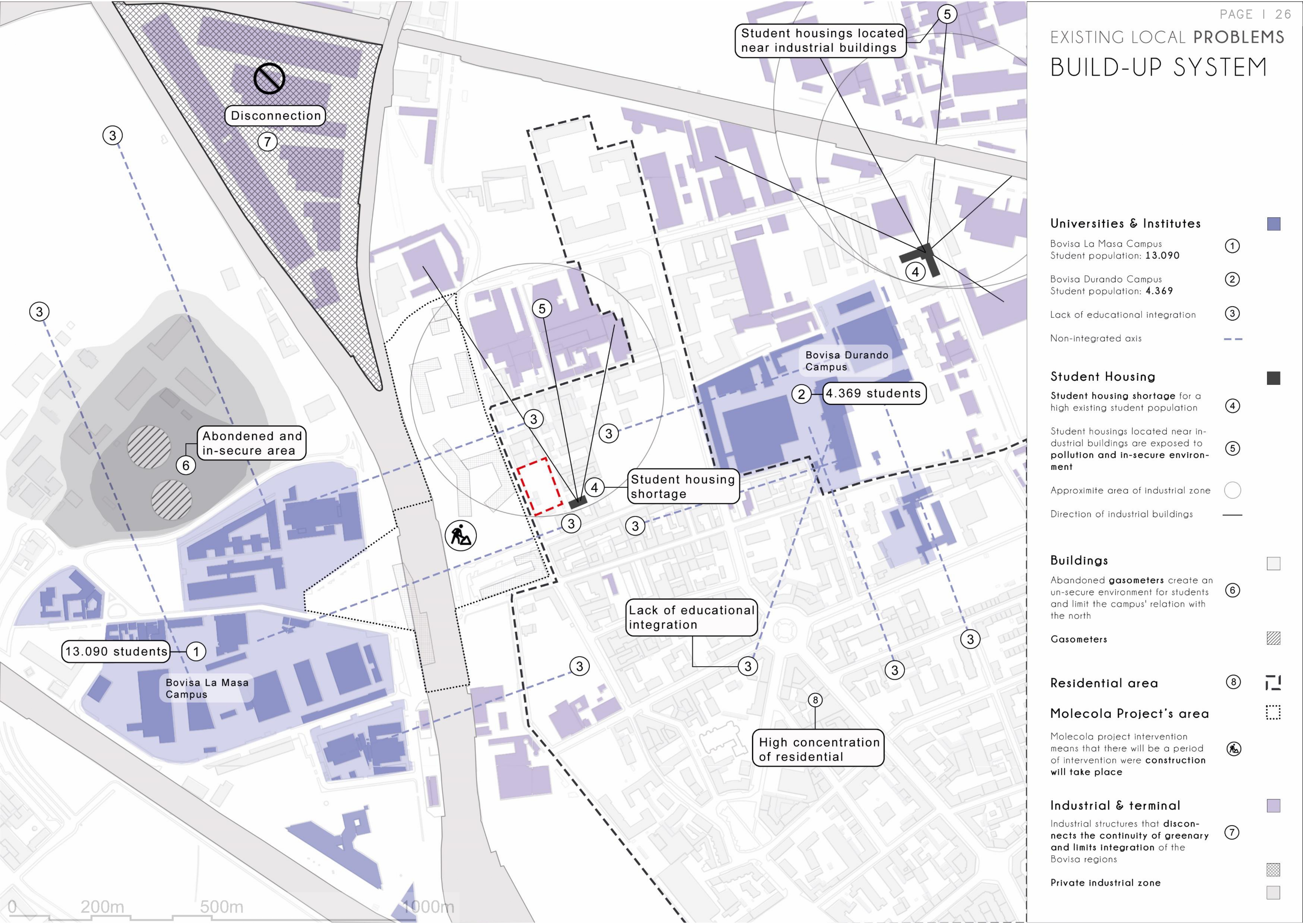
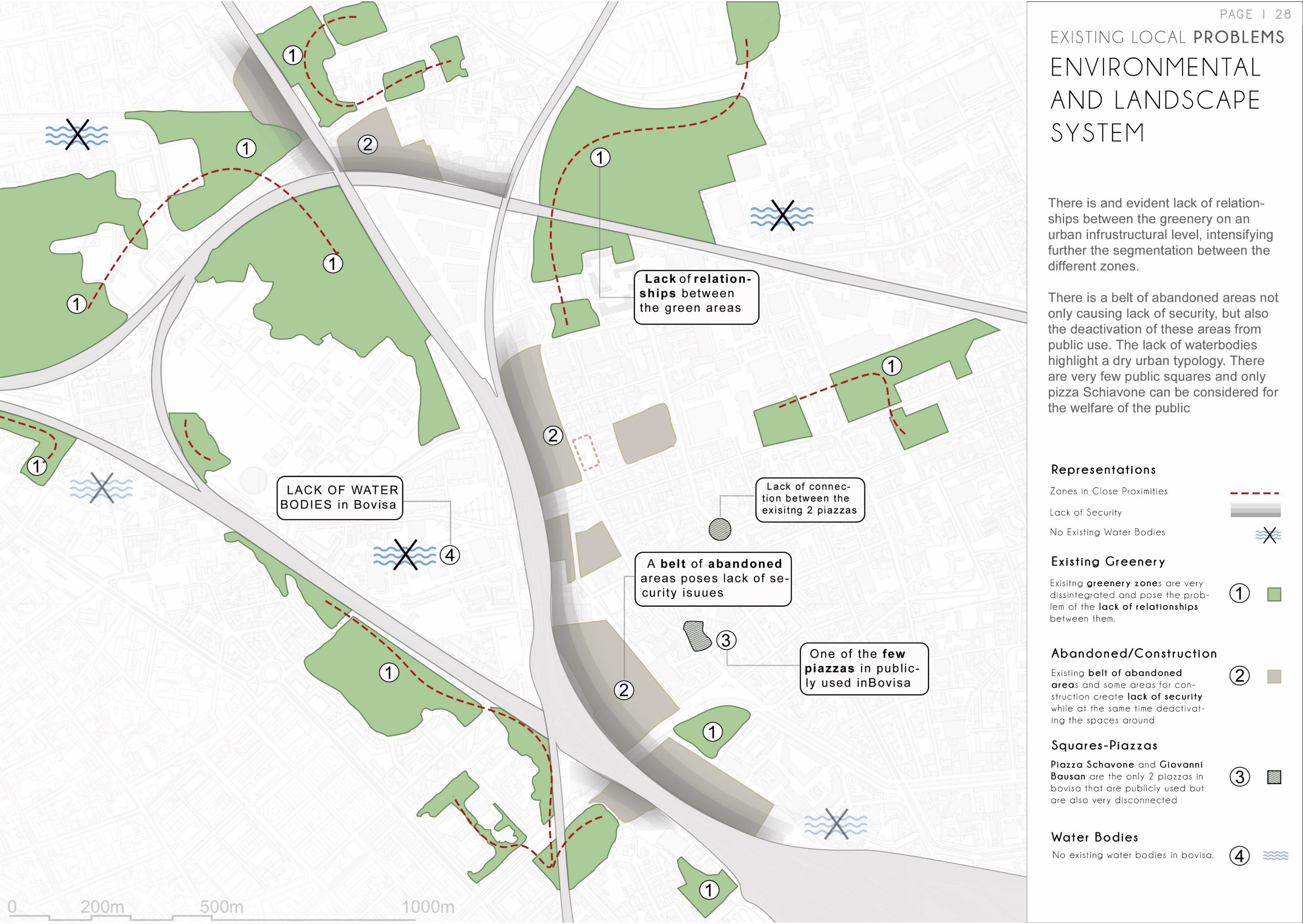
The district's problems are legible in its history. Industrial retreat left voids. The campuses generate life but don't extend it into the surrounding fabric. mobility is broken — tram routes disconnect, cycling is absent, pedestrian desire lines go unserved.
This phase maps what is broken, and why — before proposing what could be.
03
Section
Strategy & Solutions
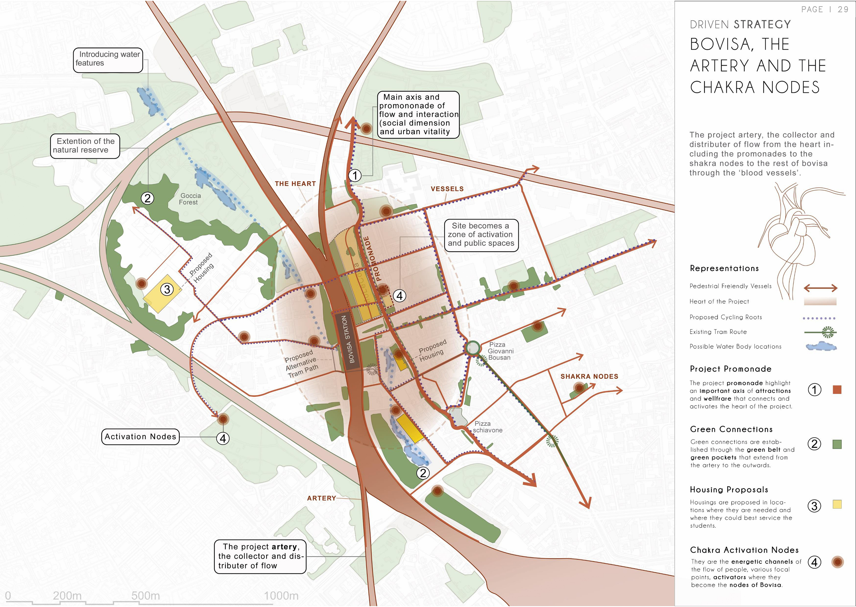
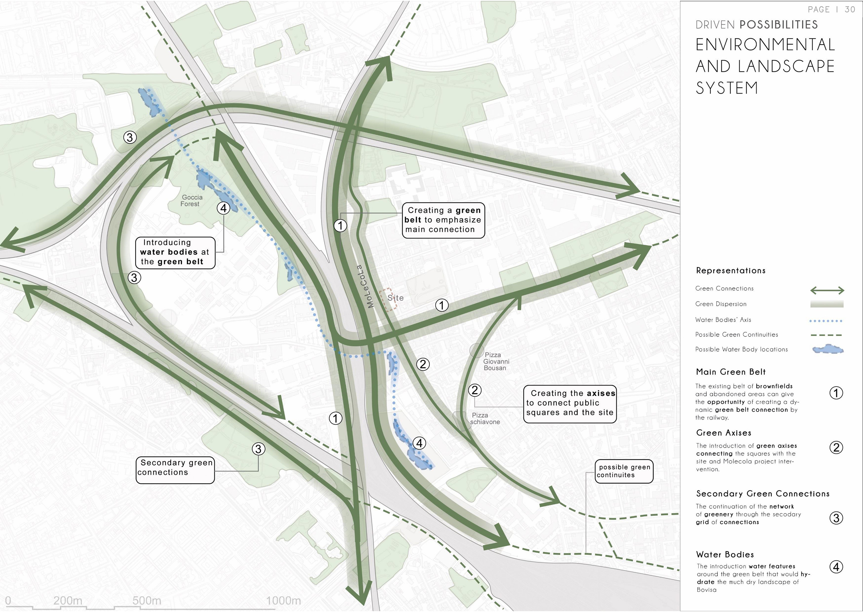
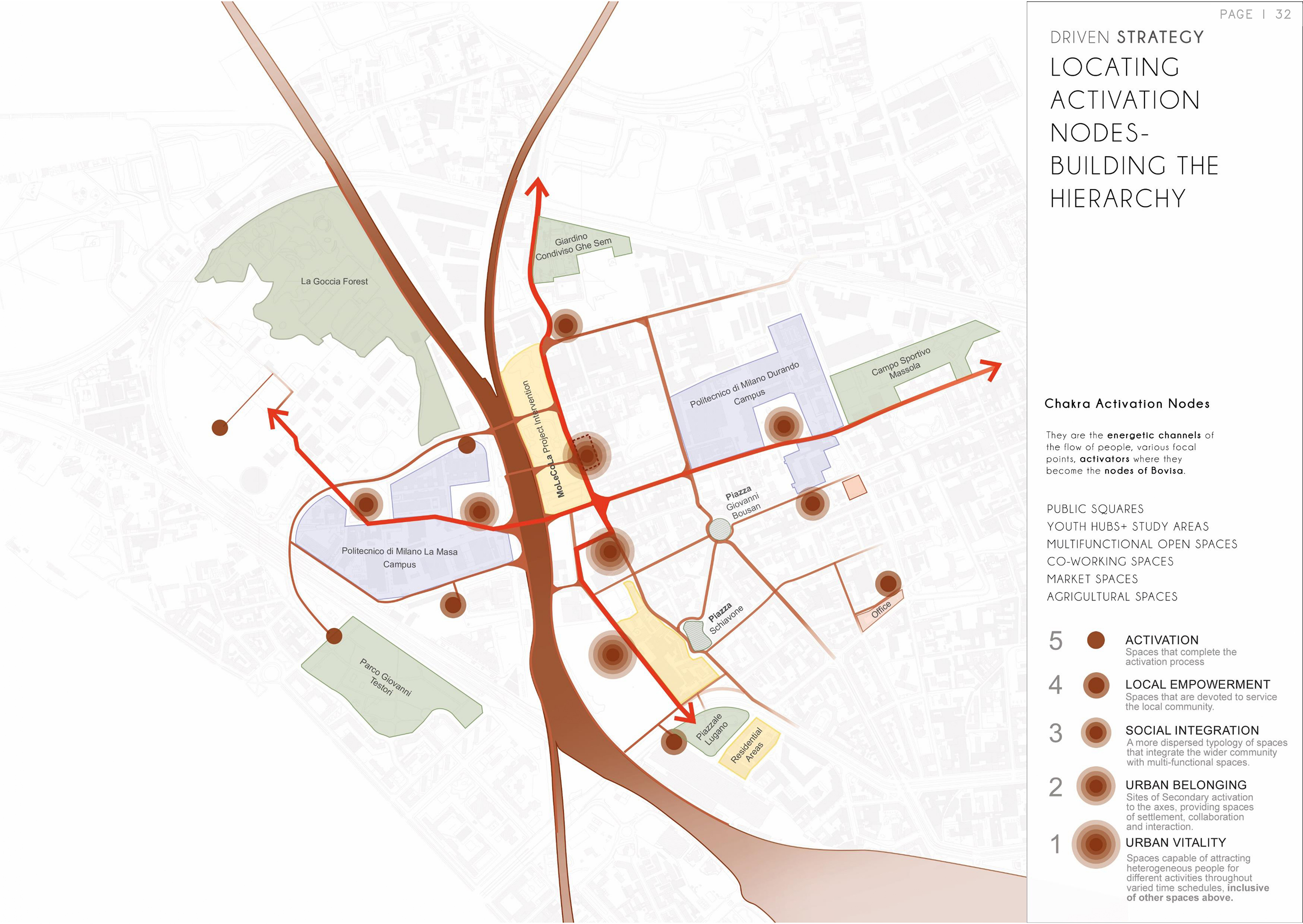
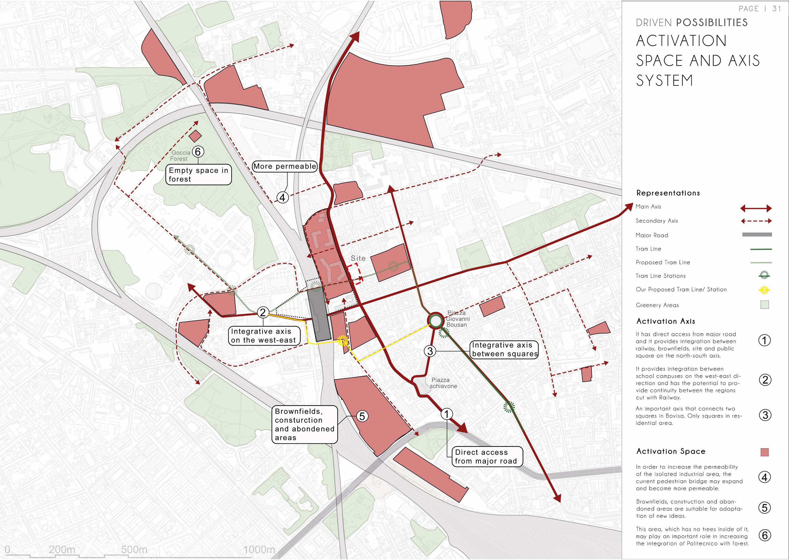
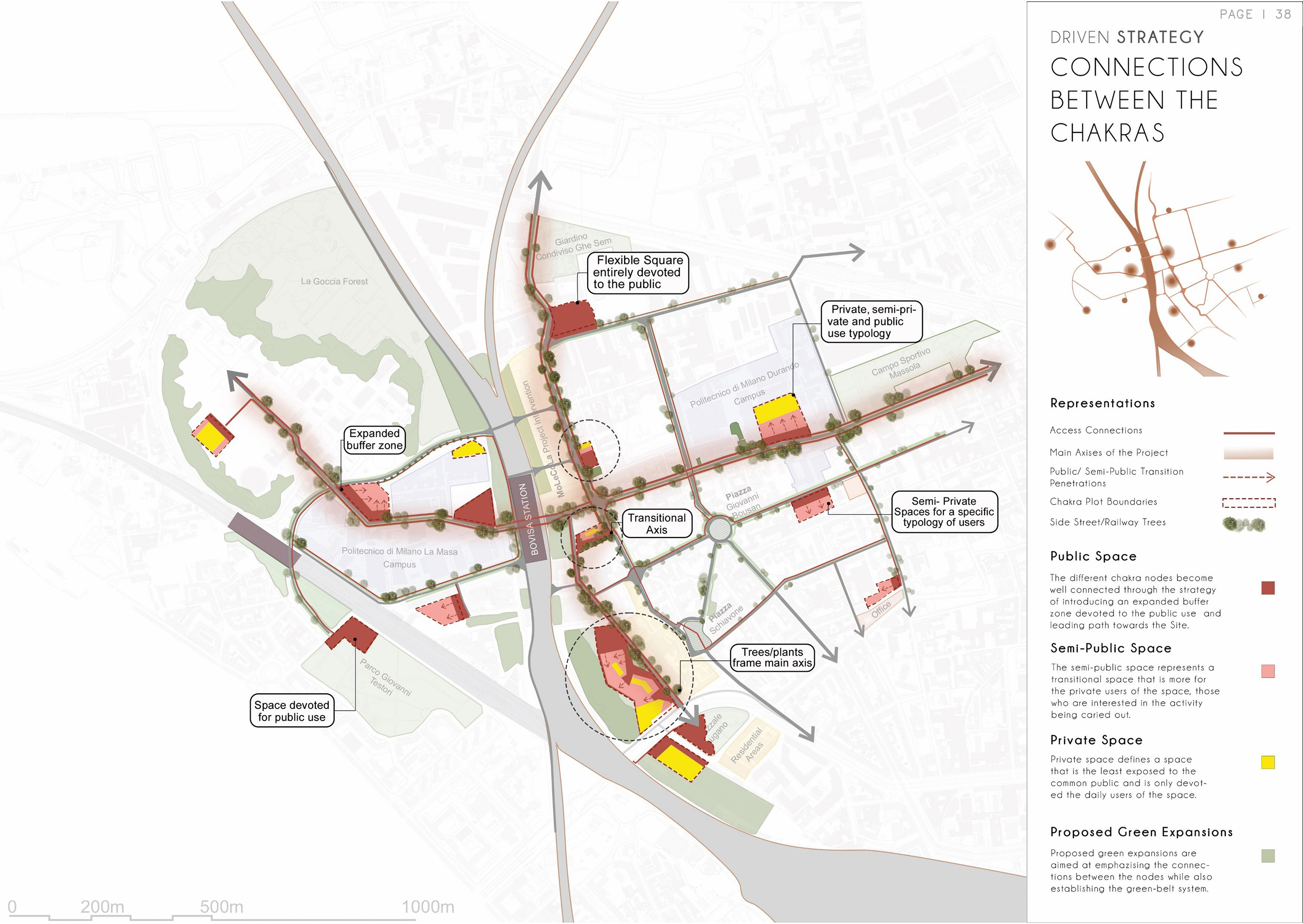
The artery is the project's primary move — a continuous spine that threads through Bovisa, connecting its campuses, squares, and green pockets into a coherent network.
Along it, chakra nodes concentrate programme and energy at the district's most critical intersections. The strategy builds on what is already there: green infrastructure, tram routes, existing social patterns — reinforcing and redirecting their potential.
Hover over each map to reveal the legend.
04
Section
Masterplan & Urban Sections
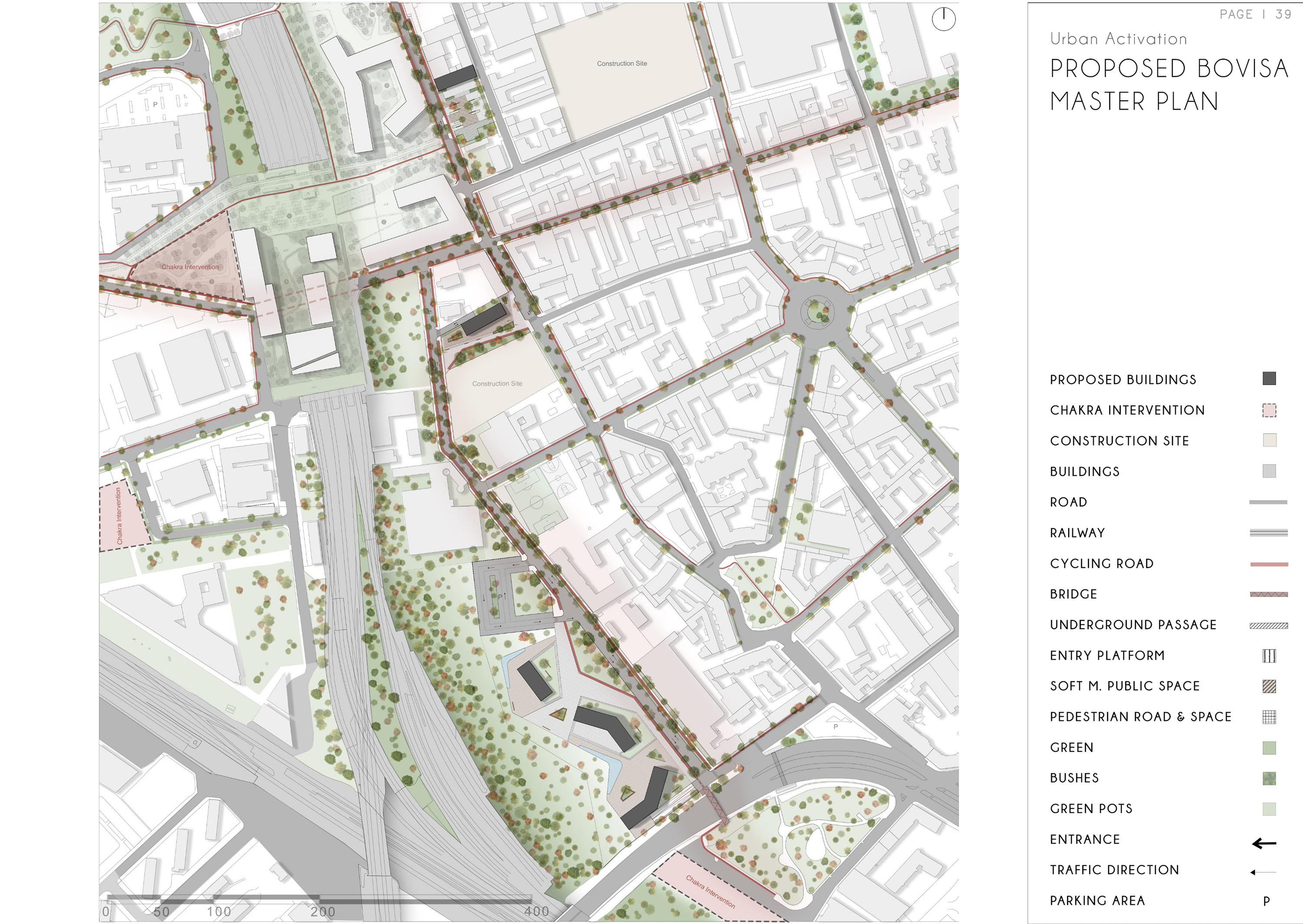
The proposed masterplan for Bovisa — a district-scale move that threads the Artery through existing fabric, activates brownfield sites, and extends green infrastructure.
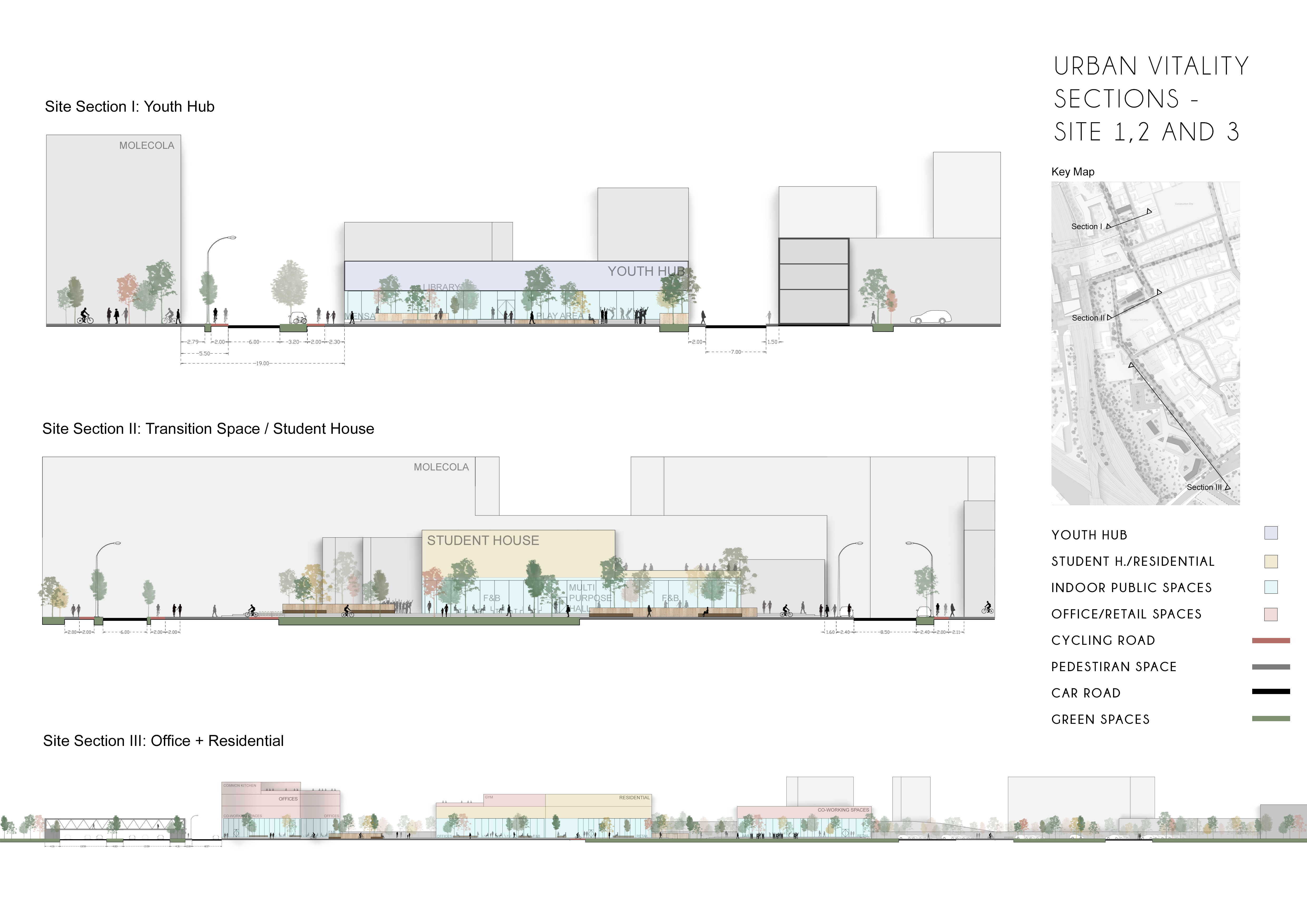
Urban sections reveal the spatial sequence along the spine: how scale shifts, how the ground is activated, and how the Artery mediates between campus, residential, and open space.
05
Section
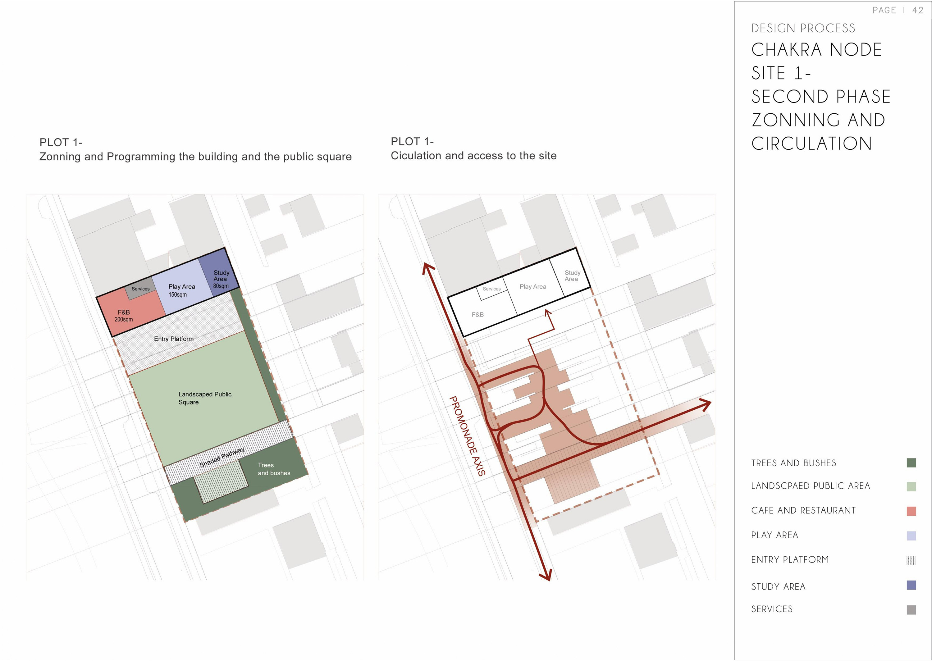
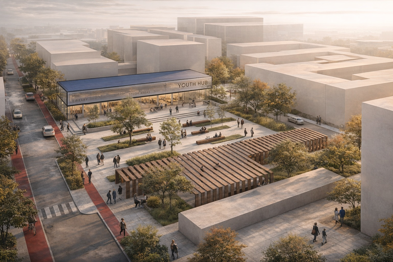
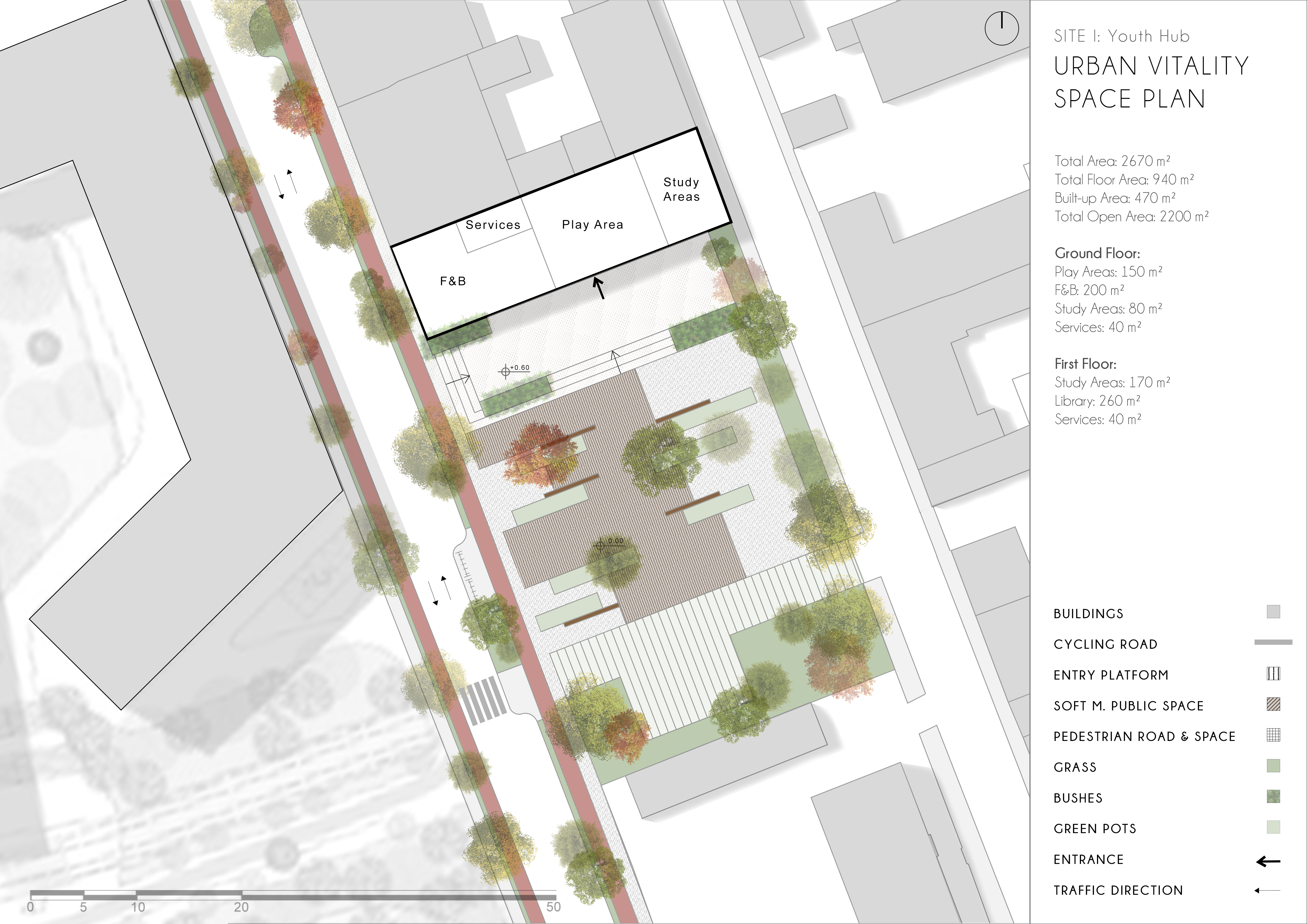
Chakra Node — Site 1
site 1 activates the first chakra along the Artery — a public square anchored by a programmed building containing café, study space, play area, and services.
The promenade axis cuts through the site, creating a legible route that draws movement from the station edge deep into the district's interior.
06
Section
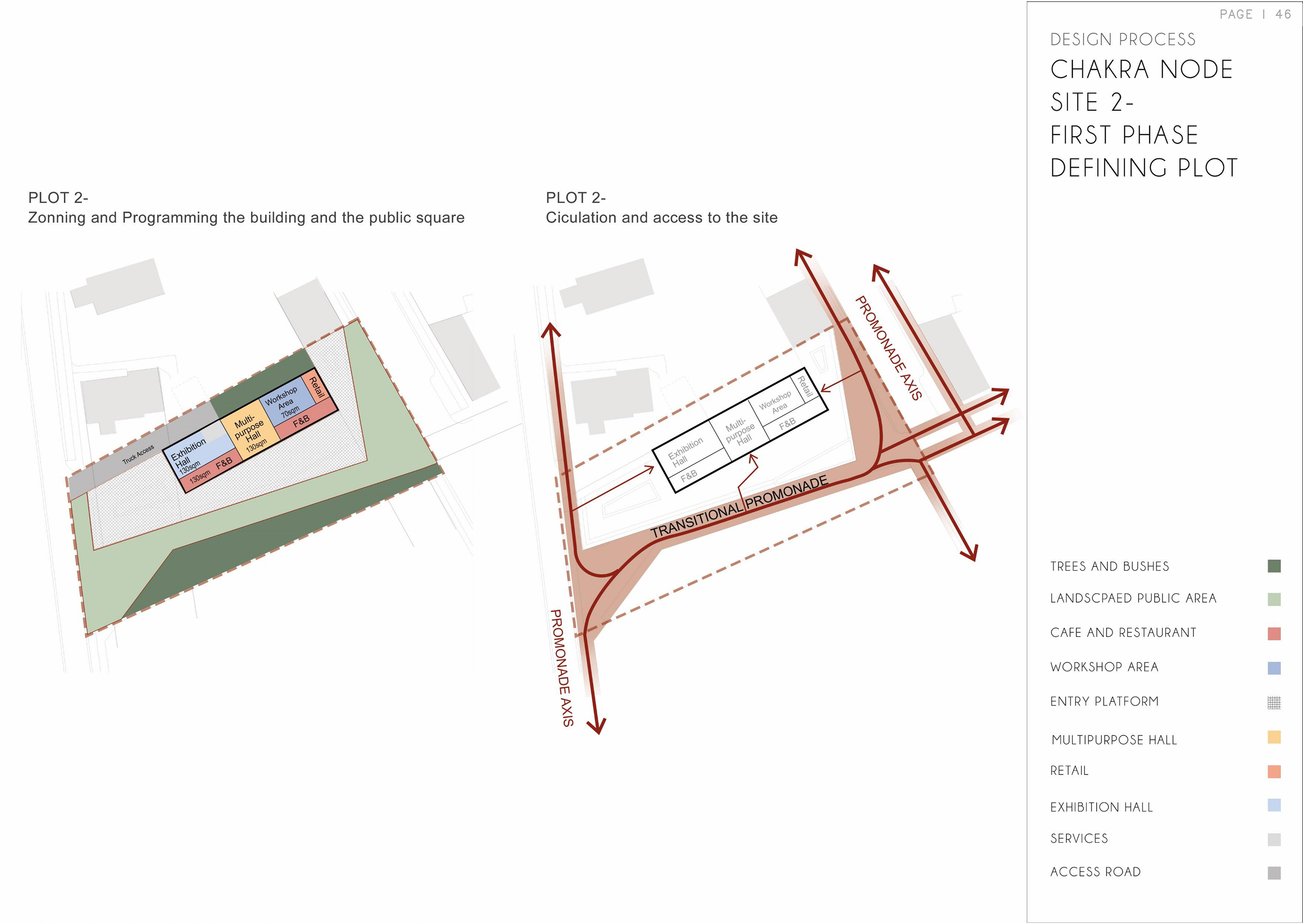
Chakra Node — Site 2
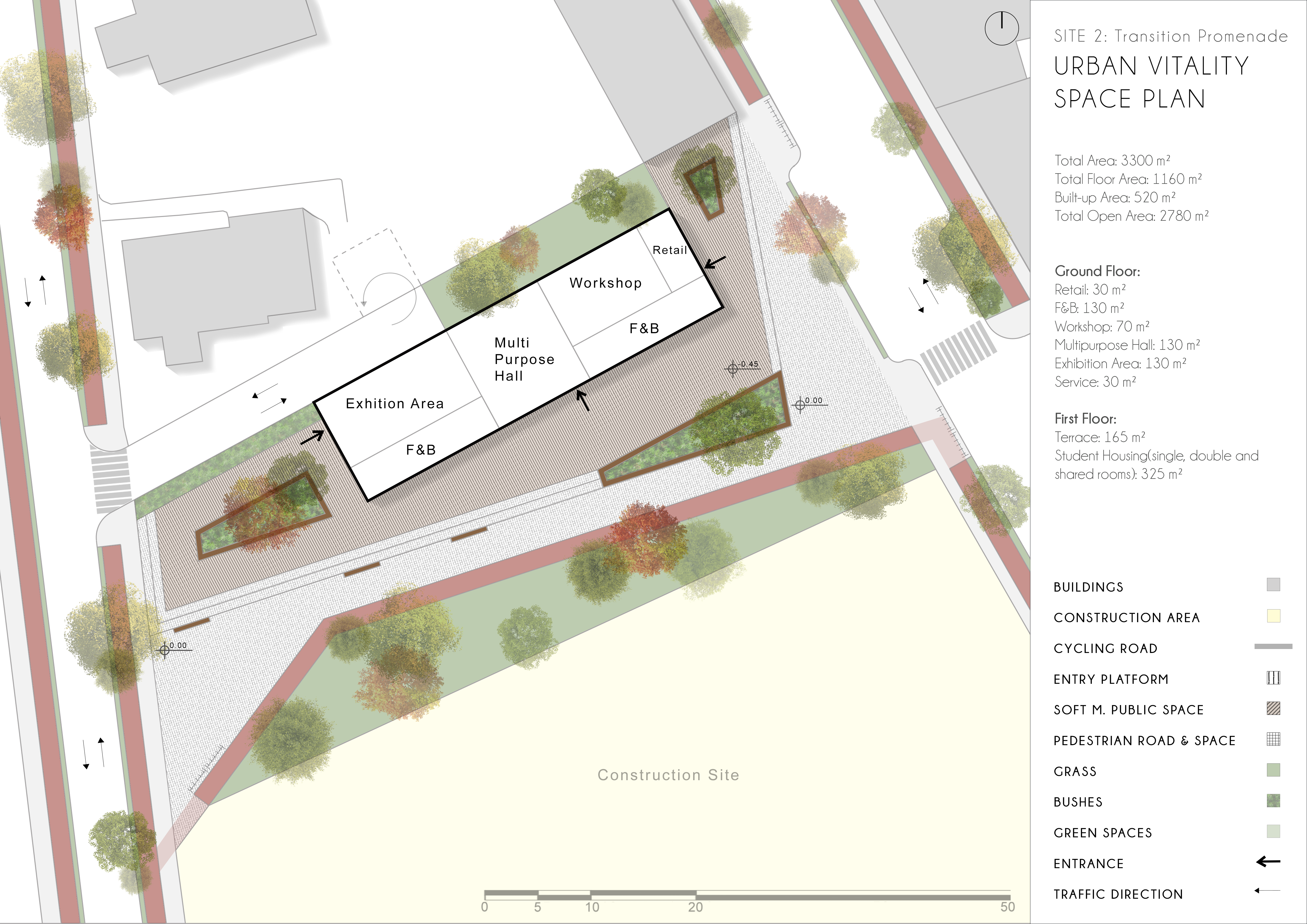
site 2 is the most complex node — an exhibition hall, multipurpose hall, and workshop spaces organised around a transitional promenade that bridges the Artery's main axis with the western residential fabric.
07
Section
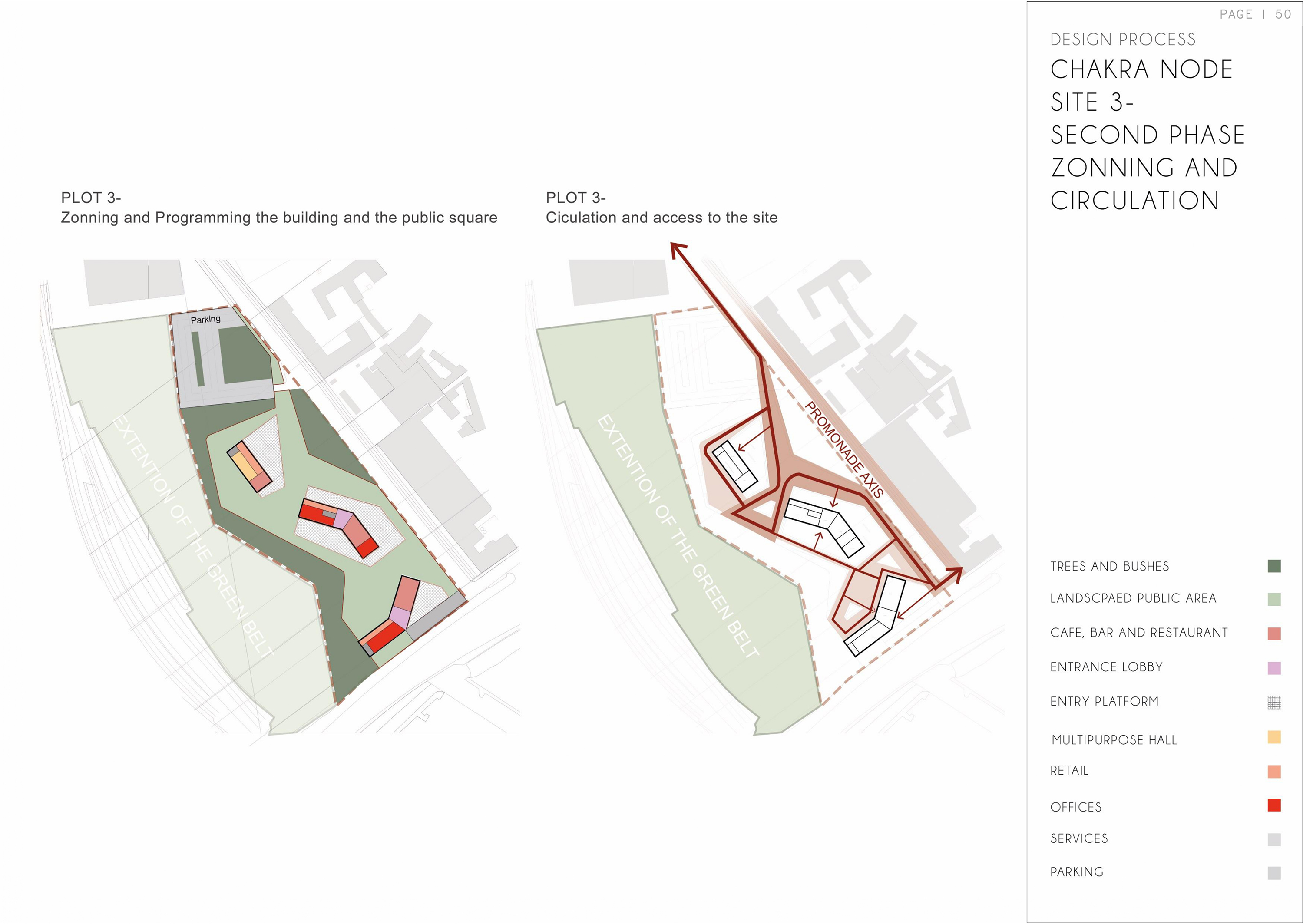
Chakra Node — Site 3
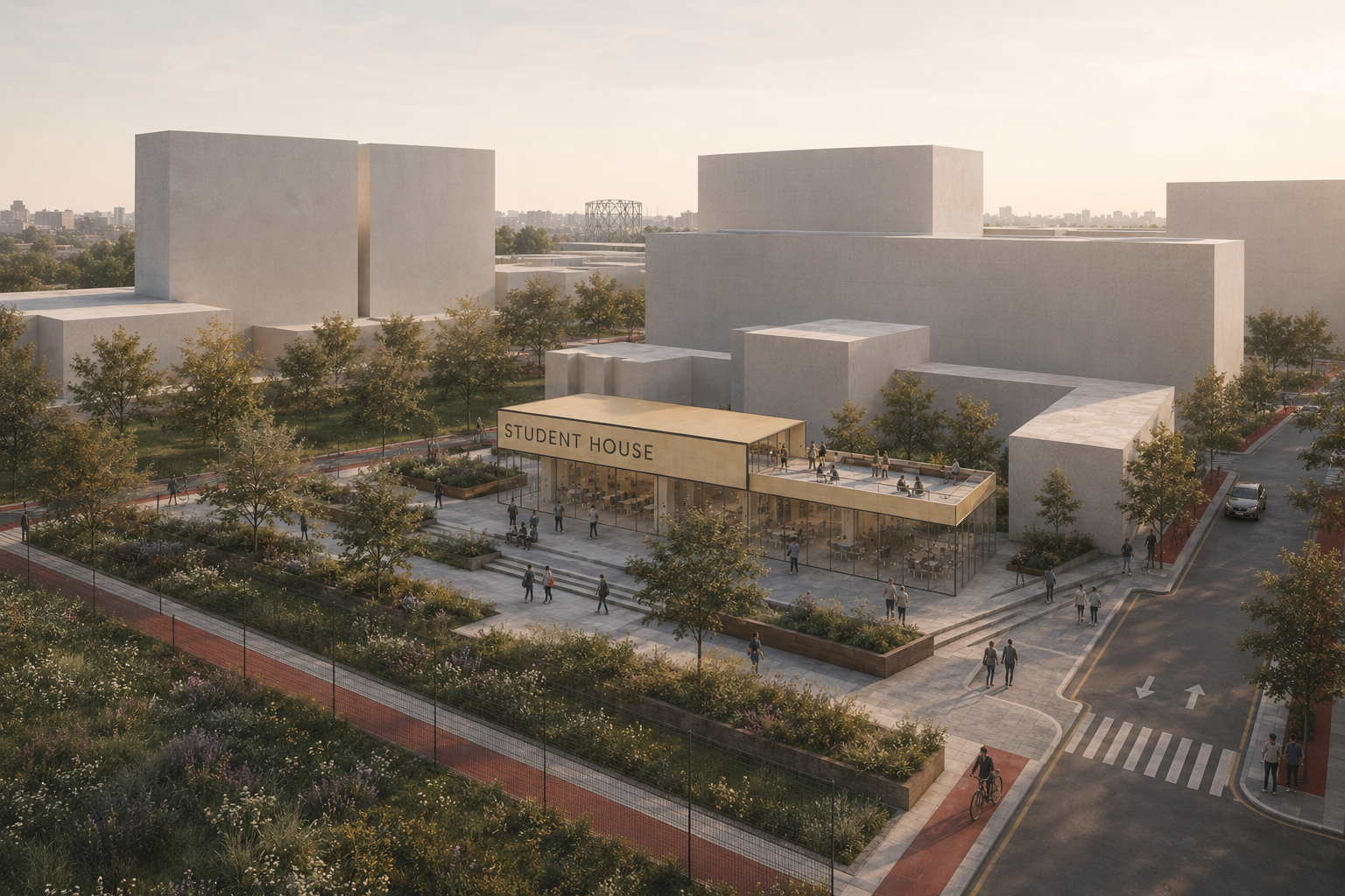
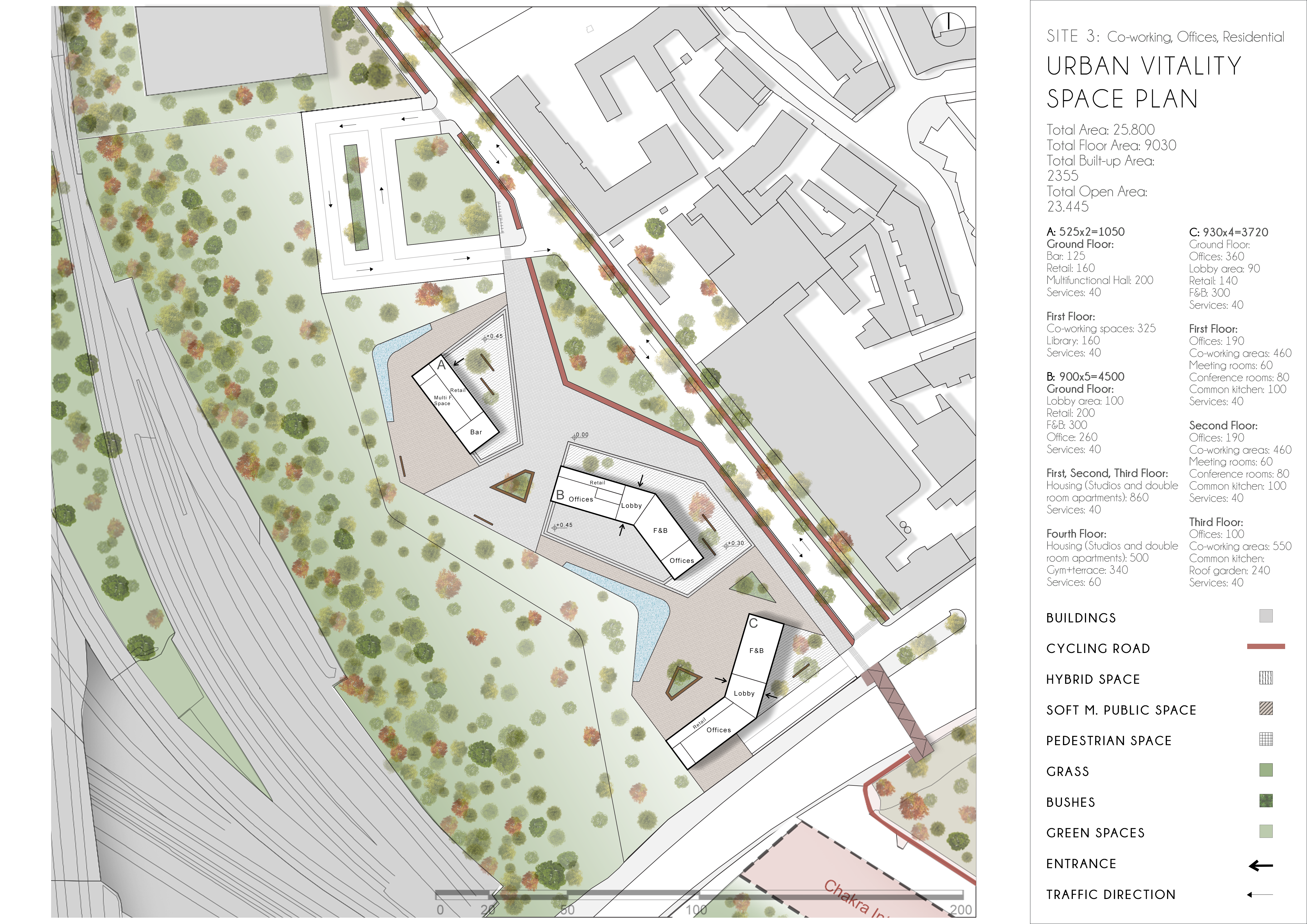
site 3 anchors the green belt extension — a node within the landscape that weaves retail, offices, café, and multipurpose programme into a landscaped setting.
The chakra here dissolves the boundary between building and open space.
08
Section
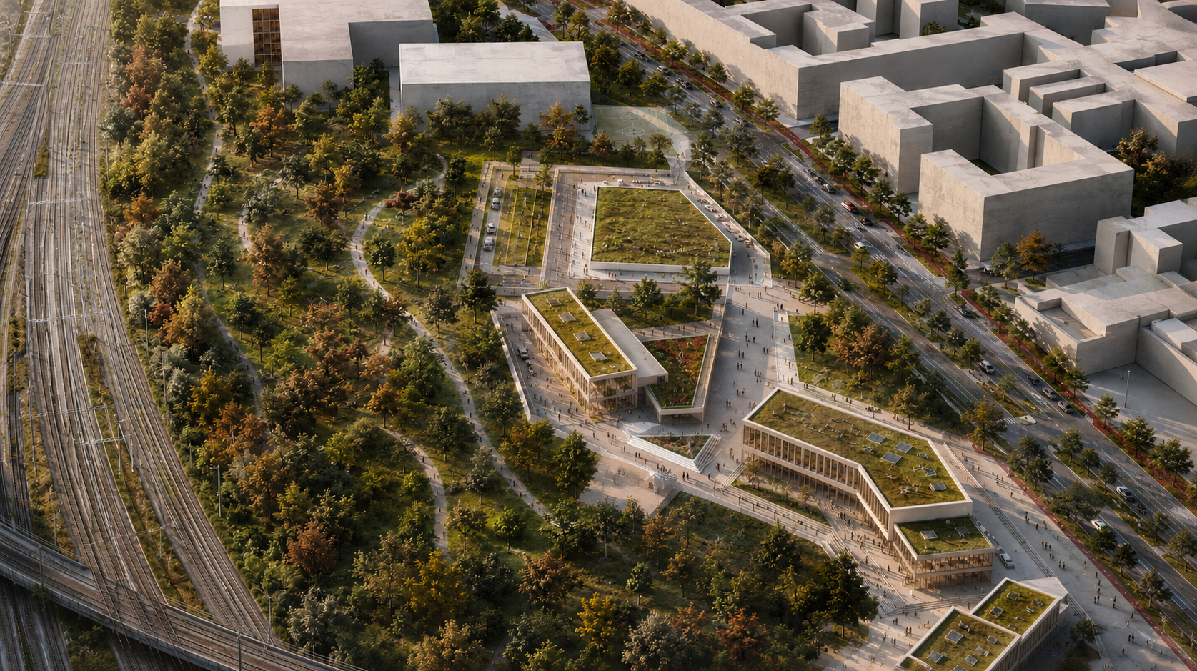
Final Aerial View
Bovisa completed — the artery spine, chakra nodes, green infrastructure, and new urban fabric seen from above.
A district that has found its backbone.